|
||||
|
||||
|
|
||||
|
||||
|
![]()
![]()
![]()
![]()
![]()
![]()
| US / World Advanced Maps | Essential US / World Maps | US / World Primary Maps | US Schools & Government Purchase Orders Accepted |
 |
 |
 |
|
| $319.99 (free ship/h) | $349.99-$399.99 (free ship/h) | $349.99-$399.99 (free ship/h) | |
| US / World Beginner Maps | Stacked US / World Maps | USA / World Maps | |
 |
 |
 |
|
| $349.99-$399.99 (free ship/h) | $104.99-$379.99 (free ship/h) | $319.99 (free ship/h) | |
| Physical Map Sets | Political Map Sets | US / World National Geographic Set | |
 |
 |
 |
|
| $360-$983 (free ship/h) | $360-$983 (free ship/h) | $399.99 (free ship/h) | |
| US / World National Geographic Set | 7 Continents National Geographic Physical Maps Set | 7 Continents National Geographic Map Set | US World Physical Map Set |
 |
 |
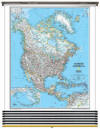 |
 |
| $399.99 (free ship/h) | $799.99 (free ship/h) | $799.99 (free ship/h) | $309.99 (free s/h) |
| Contemporary US World Combo Map Set | National Geographic US World Map Set | Classic US World Combo Map Set | |
 |
 |
 |
|
| $309.99 (free s/h) | $309.99 (free s/h) | $309.99 (free s/h) | |
|
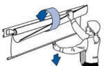
Classroom wall maps of US / States / World / Continents / Countries / Regions / Counties / Cities / Blank Panels / Other Locations are fully up to date with accurate references offering a wealth of geographical information for our changing world. Wall maps are mounted on heavy duty spring rollers in brackets with steel backboard. Maps are easy to read, printed on tough non-tear material, brightly colored, and markable with dry erase or water soluble markers. We supply Wall Maps and World Globes to classrooms at our local Monroe County School Corporation in Bloomington, Indiana, and to other schools, Colleges, private and government institutions worldwide. We accept Purchase Orders from US Educational Institutions & Government agencies.
|
|||
Call us toll-free 877-822-9889 or 812-333-2772 for orders/questions Mon.-Sat. 10:00 am-5:30 pm Eastern Standard Time
|
NATIONAL
GEOGRAPHIC
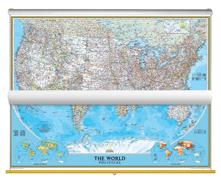
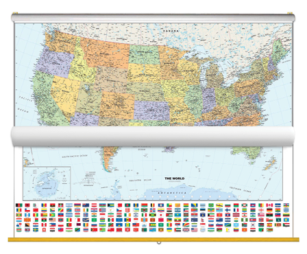
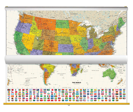
US WORLD WALL MAP SET
|
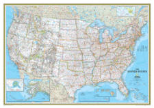
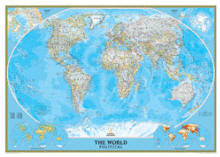
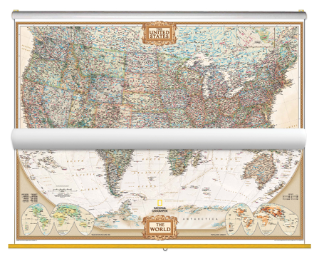
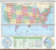
Item # NGusworld2 Sale $309.99 (free s/h) Educational and aesthetic, brighten up any classroom with this National Geographic Political US and World Map Classroom Pull Down Bundle. The World Political Map uses the Winkel Tripel projection to reduce distortion of land masses as they near the poles. Features include subtle border coloring on land, and prevailing winds and ocean currents at sea. Separate insets show the North and South Polar Regions, world vegetation and land use, and world population density. The United States Political Map uses bright color bands to outline each state. Capitals, major cities, selected towns, bodies of water, highways, and national parks are all shown. Shaded relief, rich in detail, emphasizes the many mountains, valleys, and plateaus of the USA. Both the National Geographic Political USA & World Map are printed on 24lb. premium coated bond paper. They are also laminated on both sides using 3mm hot lamination, which protects your wall maps and allows you to write on them with dry-erase markers. These laminated educational Pull Down maps are mounted to secure Spring Rollers ready to hang on any classroom wall. Wall Map Measures: 54" x 37" In Stock
|
||
|
Use COUPON CODE "10NOW" for an additional 10% DISCOUNT |
|||
|
|
|||
|
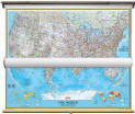
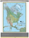
NATIONAL
GEOGRAPHIC
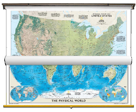
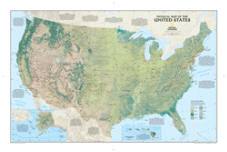
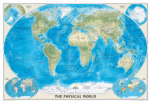
US WORLD PHYSICAL WALL MAP SET
|
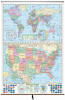
Item # NGusworldphys2 Sale $309.99 (free s/h) Educational and aesthetic, brighten up any classroom with this National Geographic Physical US and World Map Classroom Pull Down map set. The World Physical Map uses the Winkel Tripel projection to reduce distortion of land masses as they near the poles. Features include subtle border coloring on land, and prevailing winds and ocean currents at sea. Separate insets show the North and South Polar Regions, world tectonics, and world climate. See the magnificence of the US landscape with the US Physical map. The map depicts the great variety of natural vegetation in the US, from the tundra of Alaska to the desert in Arizona. Notes describe the major physical regions - from the Coastal Plain in the East to the Pacific Coast Mountains in the West, and beautiful hand-painted relief reveals topography and major features - creating a visually stunning reference map. Both the National Geographic Physical USA & World Map are printed on 24lb. premium coated bond paper. They are also laminated on both sides using 3mm hot lamination, which protects your wall maps and allows you to write on them with dry-erase markers. These laminated educational Pull Down maps are mounted to secure Spring Rollers ready to hang on any classroom wall. Wall Map Measures: 54" x 37" In Stock
|
||
|
Use COUPON CODE "10NOW" for an additional 10% DISCOUNT Call us toll-free 877-822-9889 or 812-333-2772 for orders/questions Mon.-Sat. 10:00 am-5:30 pm Eastern Standard Time |
|||
|
|
|||
|
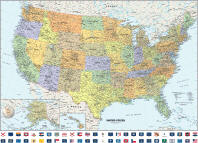
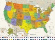
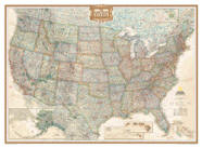
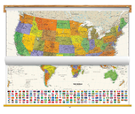
CLASSIC US/WORLD WALL MAP SET
|
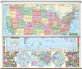
Item # MM16908 Sale $309.99 - $429.00 (free ship/h) Classic USA & World Wall Map with Flags. Pull Down Map set combines warm, attractive colors with highly detailed cartography. Includes a colorful, easy-to-read map of the world, containing flags from all major countries. Details on the United States Wall Map include: state boundaries, capitals, major cities and towns; major physical features such as mountain ranges and major mountain peaks; major water features such as oceans, seas, gulfs, and rivers; the Interstate highway system and other major roads; all National Parks as well as other large National Park Service sites; and flags of all 50 states and the District of Columbia. Printed on 24lb. premium coated bond paper. Laminated on both sides using 3mm hot lamination, which protects your wall map and allows you to write on them with dry-erase markers. These laminated educational Pull Down maps are mounted to secure Spring Rollers ready to hang on any classroom wall. Wall Map Measures: 39" x 54" Weight: 8 lb. In Stock, Ship in 1-2 days
|
||
|
Use COUPON CODE "10NOW" for an additional 10% DISCOUNT Call us toll-free 877-822-9889 or 812-333-2772 for orders/questions Mon.-Sat. 10:00 am-5:30 pm Eastern Standard Time |
|||
|
|
|||
|
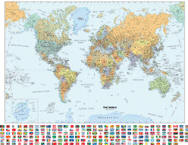
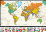
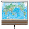
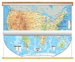
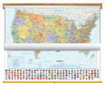
CONTEMPORARY US/WORLD WALL MAP SET
|
Item # MM16847 Sale $309.00 - $429.00 (free ship/h) Contemporary USA & World Wall Map with Flags. Classroom Pull Down map set combines bright, attractive colors with high-detailed cartography. United States Wall Map includes: state boundaries, capitals, major cities and towns; major physical features such as mountain ranges and major mountain peaks; major water features such as oceans, seas, gulfs, and rivers; the Interstate highway system and other major roads; all National Parks as well as other large National Park Service sites; and flags of all 50 states and the District of Columbia. World Map includes national boundaries, cities and capitals, shaded relief, ivory colored oceans, and a white border. Up-to-date flags from each country add color and flair to this map. Van Der Grinten projection. USA & World Maps with flags are printed on 24lb. premium coated bond paper. Laminated on both sides using 3mm hot lamination, which protects your wall maps and allows you to write on them with dry-erase markers. Pull Down wall maps are mounted to secure Spring Rollers ready to hang on any classroom wall. Wall Map Measures: 39" x 54" Weight: 8 lb. In Stock, Ship in 1-2 days
|
||
|
Use COUPON CODE "10NOW" for an additional 10% DISCOUNT Call us toll-free 877-822-9889 or 812-333-2772 for orders/questions Mon.-Sat. 10:00 am-5:30 pm Eastern Standard Time |
|||
|
|
|||
|
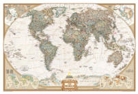
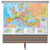
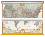
NATIONAL GEOGRAPHIC US/WORLD
ANTIQUE TONES WALL MAP SET
|
Item # MM16960 Sale $309.00 - $429.00 (free ship/h) This richly colored Antique Tones US and World Map Classroom Pull Down set features the incredible cartographic detail that is the trademark quality of National Geographic. The World Map features a Tripel Projection which reduces distortion of land masses as they near the poles. Corner inset maps feature vegetation, land use and population density. This elegant map is a winner of the Premier Print Award from Printing Industries of America for 'a unique ability to create visual masterpieces.' It also is the winner of the Best Reference Map from the American Congress on Surveying & Mapping. The rich tones of the USA Wall Map combine the popular antique look with up-to-date information, making this bundle an education and aesthetic choice for any classroom. Both the National Geographic Antique Tones USA & World Map are printed on 24lb. premium coated bond paper. Laminated on both sides using 3mm hot lamination, which protects your wall maps and allows you to write on them with dry-erase markers. Pull Down maps are mounted to secure Spring Rollers ready to hang on any classroom wall. Wall Map Measures: 39" x 54" Weight: 8 lb. In Stock, Ship in 1-2 days
|
||
|
Use COUPON CODE "10NOW" for an additional 10% DISCOUNT Call us toll-free 877-822-9889 or 812-333-2772 for orders/questions Mon.-Sat. 10:00 am-5:30 pm Eastern Standard Time |
|||
|
|
|||
|
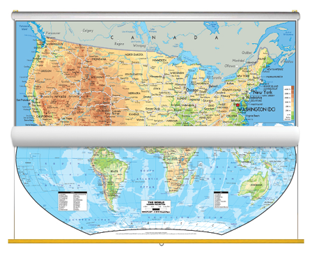
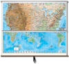
US/WORLD
PHYSICAL WALL MAP SET
|
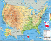
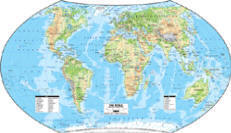
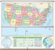
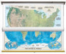
Item # MM16755 Sale $309.00 - $429.00 (free ship/h) Physical USA and World Map Classroom Pull Down set was created with state-of-the-art printing technology, using attractive colors and easy-to-read text. This map is ideally suited for the classroom. Both the Physical USA and World Map are printed on 24lb. premium coated bond paper. Laminated on both sides using 3mm hot lamination, which protects your wall maps and allows you to write on them with dry-erase markers. Pull Down maps are mounted to secure Spring Rollers ready to hang on any classroom wall.
Wall Map Measures: 30" x 54" Weight: 8 lb. In Stock, Ship in 1-2 days
|
||
|
Use COUPON CODE "10NOW" for an additional 10% DISCOUNT Call us toll-free 877-822-9889 or 812-333-2772 for orders/questions Mon.-Sat. 10:00 am-5:30 pm Eastern Standard Time |
|||
|
|
|||
|
Home | Products | About Us | Contact Us | Helpful Links | Return and Privacy Policies | Site Map | International Orders |
||||||||||||||
|
|
|||||||||||||
|
Site Map | Privacy Policy | Easy Return/Exchanges | APO/FPO Orders | No Minimum Order + FREE Shipping (contiguous USA) |
||||||||||||||