|
||||
|
||||
|
![]()
![]()
![]()
![]()
![]()
![]()
Wall Maps > US / World Political Map
-
Sale $314.99 - $344.99 (free ship/h)
Retail:
$
385-$425or 6 monthly installments of $52.50 - $57.50 with PayPal Credit
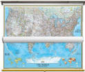
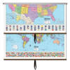
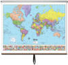
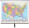
USA & World - Advanced Classroom Pull Down Wall Map Sets on Rollers
|
|
|||||
|
Item #
KP28000
- Bestseller
In Stock
Wall Map Measures: 63" x 54" Weight: 9 lb.
|
|||||
|
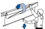
The US World Advanced Political Classroom Wall Map Set offers a wealth of valuable information, including continents, individual country boundaries, capitals, major cities and waterways, and the latest international name changes. Created with legibility in mind, this brightly colored up to date map highlight the world with detailed cartography, is easy to read, printed on tough non-tear material, and is markable. Wall maps are mounted on a roller and are offered with or without backboard support. Appropriate for grades 6-12, and satisfying state and national curriculum standards, the Advanced Political Classroom Wall Map is a must-have for every classroom. Wall map is ideal for public, private, parochial, and home schools.
|
|||||


Call us toll-free 877-822-9889 or 812-333-2772 for orders/questions Mon.-Sat. 10:00 am-5:30 pm Eastern Standard Time
| 7 Continents National Geographic Map Set | US / World National Geographic Set | US / World Combo Sets | World Wall Maps | USA Wall Maps |
 |
 |
 |
 |
 |
| $999.99 (free ship/h) | $314.99 (free ship/h) | $319.00 (free ship/h) | $64.99 - $364.99 (free s/h) | $64.99 - $364.99 (free s/h) |
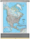
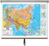
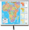
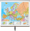
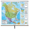
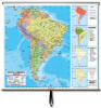
| Asia Wall Map | Africa Wall Map | Europe Wall Map | North America Map | South America Map |
 |
 |
 |
 |
 |
| $99 - $250 (free s/h) | $99 - $250 (free s/h) | $99 - $250 (free s/h) | $99 - $250 (free s/h) | $99 - $250 (free s/h) |
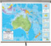
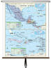
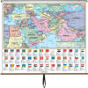
| Australia Wall Map | Central America Map | Middle East & S. Asia | ||
 |
 |
 |
 |
|
| $99 - $250 (free s/h) | $199.00 (free ship/h) | $199.00 (free ship/h) | ||
Large US World Wall Map Sets, classroom maps, pull down maps, spring roller maps, pull up maps