|
||||
|
||||
|
![]()
![]()
![]()
![]()
![]()
![]()
- World Executive Explorer - Illuminated Map by Lightravels Item # NGEWM
|
Out of Stock
|
|
|
|
|
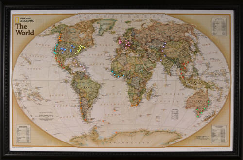
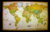
National Geographic laminated map features antique-style color palette,
present-day political boundaries and place names. Contains fact boxes
listing key geographic information: the world's largest and most populated
countries as well as largest cities. Durable lamination offers endless
opportunities for route planning, memorable trip tracking,
business/customer locations, and much more.
See this map really come to life when you insert the
Lightravels light pegs anywhere
you want on the map surface!
Includes energy efficient fluorescent bulbs and ballasts, 60
light pegs (ten pieces in six colors).
100 additional light pegs (10 pieces in 10 colors) are
available for purchase.
Personalized plaques (4" x 1") - please enter text in
the special instructions section of the shopping cart.
|
|
|
|
|
Call us toll-free 877-822-9889 or 812-333-2772 for orders/questions Mon.-Sat. 10:00 am-5:30 pm Eastern Standard Time
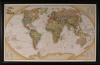
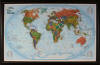
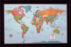
| Executive World Map | World Explorer Map | Modern World Map | Classic World Map | ||||||||||||
|
|
|
|
||||||||||||
| $224.99 (free ship/h) | $224.99 (free ship/h) | $224.99 (free ship/h) | $224.99 (free ship/h) | ||||||||||||
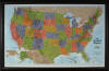
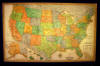
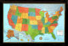
| USA Explorer Map | USA Classic Map | USA Modern Map | |||||||||||||
|
|
|
View Lighted Map Video | ||||||||||||
| $224.99 (free ship/h) | $224.99 (free ship/h) | $224.99 (free ship/h) | |||||||||||||
World Executive Explorer Illuminated Wall Map by Lightravels, Item # NGWM
Sale Price: $224.99, Interactive Educational Map, National Geofraphic, Makes a Great Gift