|
||||
|
||||
|
|
||||
|
||||
|
![]()
![]()
![]()
![]()
![]()
![]()
Wall Maps > State Maps > Florida
| Florida Intermediate Thematic Map | Florida Shaded Relief Wall Map |
|
|||||||||||||||||||||||||
 |
 |
||||||||||||||||||||||||||
| $125.99 - $514.99 (free s/h) | $99.99 - $539.99 (free s/h) | ||||||||||||||||||||||||||
| Florida Primary Thematic Map | Florida State Wall Map | ||||||||||||||||||||||||||
 |
 |
||||||||||||||||||||||||||
| $125.99 - $514.99 (free s/h) | $125.99 - $560.99 (free s/h) | ||||||||||||||||||||||||||
| Additional Florida Maps | |||||||||||||||||||||||||||
 |
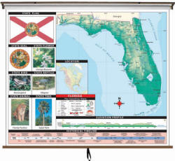
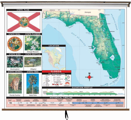
Item # KP16645 The Florida Large Scale Shaded Relief Topographical Wall Map is laminated, making it durable, markable, and easy to clean. Map is full-color and includes historical, anecdotal, and geographical information, an elevation scale measured in meters and feet, and a distance scale measured in miles and kilometers. Identifies county boundaries, the state flag, motto, bird, flower, and tree, plus total area, population, and origin of name.
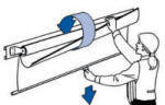
Please click here to view samples of Map Mounting Options
|
||||||||||||||||||||||||||
|
|||||||||||||||||||||||||||
|
|||||||||||||||||||||||||||
|
|
|||||||||||||||||||||||||||
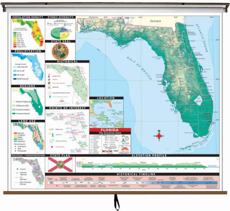 |
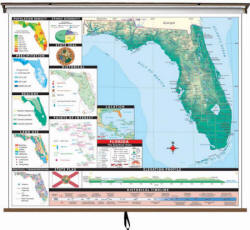
Item # KP26411 The Florida State Intermediate Thematic Wall Map is the perfect teaching aid for state studies and related subjects. Political/physical maps with hypsometric colorations; shows county boundaries, interstate highways, county seats, cities and towns and state regions. Maps correlate with state standards and curriculum guidelines. They are constructed of heavy paper, with a write-on/wipe-off laminated finish that can be used with water-based or dry erase pens. Map is printed on 64"W x 54"H panel.
|
||||||||||||||||||||||||||
|
Please click here to view samples of Map Mounting Options
|
|||||||||||||||||||||||||||
|
|||||||||||||||||||||||||||
|
|
|||||||||||||||||||||||||||
 |
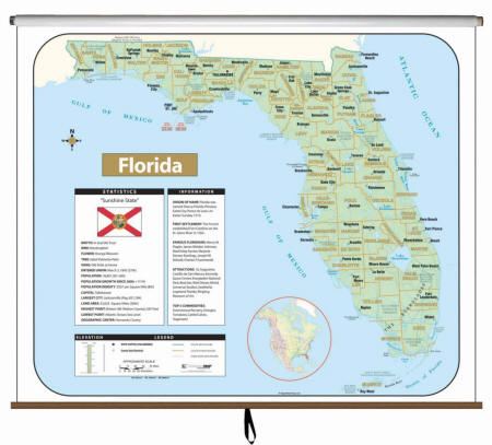
Item # KP26350 The Florida State Primary Thematic Wall Map is the perfect teaching aid for state studies and related subjects. Political/physical maps with hypsometric colorations; shows county boundaries, interstate highways, county seats, cities and towns and state regions. Maps correlate with state standards and curriculum guidelines. They are constructed of heavy paper, with a write-on/wipe-off laminated finish that can be used with water-based or dry erase pens. This product is ideal for public, private, parochial, and home schools. Map is printed on 64"W x 54"H panel.
|
||||||||||||||||||||||||||
|
Please click here to view samples of Map Mounting Options
|
|||||||||||||||||||||||||||
|
|||||||||||||||||||||||||||
|
|
|||||||||||||||||||||||||||
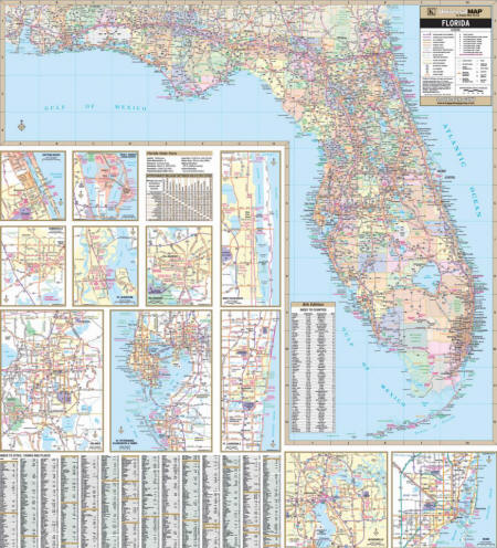 |
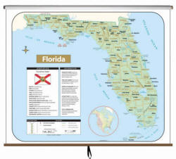
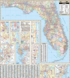
Item # KP11412 The 2nd edition Florida State Wall Map is laminated, markable, and has washable surface. Printed on a scale of 1” = 6.5 miles. Indexed on the map’s face. Provides color-coded counties, a mileage chart between major cities. Other features include all state and federal highways, major waterways, state universities, military installations, airports, hospitals, state and national parks, points of interest, cities and towns complete with populations, wildlife areas, and rest areas. Wall Map Measures: 53.3" x 59.5"
|
||||||||||||||||||||||||||
|
Please click here to view samples of Map Mounting Options
|
|||||||||||||||||||||||||||
|
|||||||||||||||||||||||||||
|
|
|||||||||||||||||||||||||||
USA / World / Florida - 3 Map
Set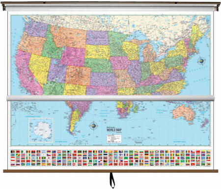 Please let us know which of the Florida State Maps you would like to include in this custom made map set. You can add this information in the Special Instructions section of the Sopping Cart. If interested in regional and city maps, please call 877-822-9889 or email us at traveler@bluemarble.net.
|
Item # KP30585 State of California map is available as a part of 3 map combination set of USA/World/California State $599.99 (free s/h) Make the best use of your space with these multi-map sets providing a wealth of valuable information including country and state boundaries as well as capitals, major waterways, and major cities. This high quality series meets national and state curriculum standards. All maps in this series are markable with a dry erase or water-soluble marker. Durably laminated maps measure 64″ x 54”, and are mounted on roller with backboard.
|
||||||||||||||||||||||||||
|
|||||||||||||||||||||||||||
Call us toll-free 877-822-9889 or 812-333-2772 for orders/questions Mon.-Sat. 10:00 am-5:30 pm Eastern Standard Time
Florida State Map by Universal Maps, Item # KP-State
Sale Price: $99.99 - $674.99, Classroom Map, Up-to-date Cartography, Pull-down Map, Wall Map, Laminated Maps, Large Wall Map, Markable Maps, Wall Map on Roller
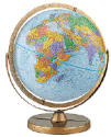
Educational Maps are designed to present the world in a way that is visually appealing and east to understand
|
Home | Products | About Us | Contact Us | Helpful Links | Order, Return & Privacy Policies | Site Map | International Orders |
||||||||||||||
|
|
|||||||||||||
|
Site Map | Privacy Policy | Easy Return/Exchanges | APO/FPO Orders | No Minimum Order + FREE Shipping (contiguous USA) |
||||||||||||||