|
||||
|
||||
|
|
||||
|
||||
|
![]()
![]()
![]()
![]()
![]()
![]()
Wall Maps > State Maps > New York
| New York Shaded Relief Wall Map | New York State Wall Map |
|
|||||||||||||||||||||||||
 |
 |
||||||||||||||||||||||||||
| $99.99 - $539.99 (free s/h) | $109.99 - $550.99 (free s/h) | ||||||||||||||||||||||||||
| New York / USA / World - 3 Map Set | Additional New York Maps | ||||||||||||||||||||||||||
 |
New York City 5 Boroughs Wall Map
|
||||||||||||||||||||||||||
| $599.99 - $674.99 (free s/h) | |||||||||||||||||||||||||||
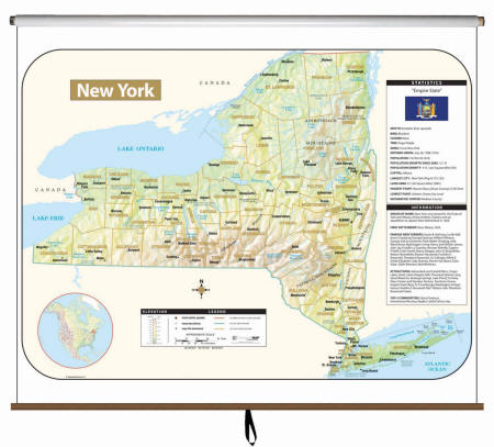 |
Item # KP16717 The New York Large Scale Shaded Relief Topographical Wall Mapis laminated, making it durable, markable, and easy to clean. Map is full-color and includes historical, anecdotal, and geographical information, an elevation scale measured in meters and feet, and a distance scale measured in miles and kilometers. Identifies county boundaries, the state flag, motto, bird, flower, and tree, plus total area, population, and origin of name.
|
||||||||||||||||||||||||||
|
|||||||||||||||||||||||||||
|
|||||||||||||||||||||||||||
|
|
|||||||||||||||||||||||||||
|
|
|||||||||||||||||||||||||||
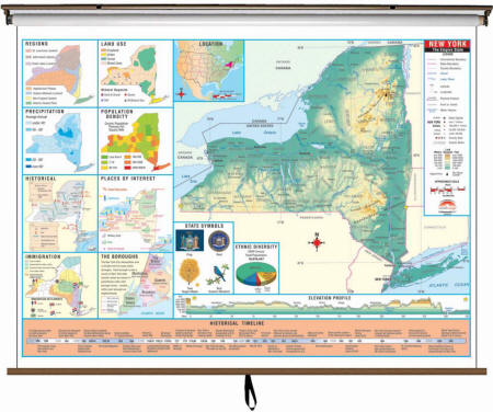 |
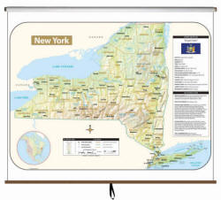
Item # KP26434 The New York State Intermediate Thematic Wall Map is the perfect teaching aid for state studies and related subjects. Political/physical maps with hypsometric colorations; shows county boundaries, interstate highways, county seats, cities and towns and state regions. Maps correlate with state standards and curriculum guidelines. They are constructed of heavy paper, with a write-on/wipe-off laminated finish that can be used with water-based or dry erase pens. Map is printed on 64"W x 54"H panel.
|
||||||||||||||||||||||||||
|
|||||||||||||||||||||||||||
|
|
|||||||||||||||||||||||||||
 |
Item # KP26373 The New York State Primary Thematic Wall Map is the perfect teaching aid for state studies and related subjects. Political/physical maps with hypsometric colorations; shows county boundaries, interstate highways, county seats, cities and towns and state regions. Maps correlate with state standards and curriculum guidelines. They are constructed of heavy paper, with a write-on/wipe-off laminated finish that can be used with water-based or dry erase pens. Mounted on spring roller with backboard. This product is ideal for public, private, parochial, and home schools.
|
||||||||||||||||||||||||||
|
|||||||||||||||||||||||||||
|
|
|||||||||||||||||||||||||||
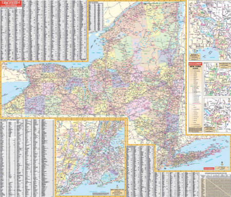 |
Item # KP17592 The New York State Wall Map features laminated, markable, and washable surface. Indexed on the map’s face. Provides color-coded counties, a mileage chart between major cities, and framing rails mounted top and bottom. Other features include all state and federal highways, major waterways, state universities, military installations, airports, hospitals, state and national parks, points of interest, cities and towns complete with populations, wildlife areas, and rest areas. Wall Map Measures: 62" x 42"
|
||||||||||||||||||||||||||
|
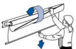
Please click here to view samples of Map Mounting
Options
|
|||||||||||||||||||||||||||
|
|
|||||||||||||||||||||||||||
USA / World / New York - 3 Map
Set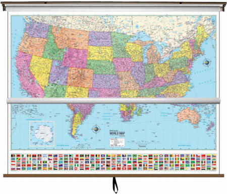 Please let us know which of the New York Maps you would like to include in this custom made map set. You can add this information in the Special Instructions section of the Sopping Cart. |
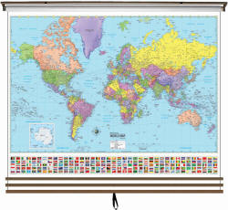
Item # KP30585 State of New York map is available as a part of 3 map combination set of USA/World/New York State $599.99 (free s/h) Make the best use of your space with these multi-map sets providing a wealth of valuable information including country and state boundaries as well as capitals, major waterways, and major cities. This high quality series meets national and state curriculum standards. All maps in this series are markable with a dry erase or water-soluble marker. Durably laminated maps measure 64″ x 54”, and are mounted on roller with backboard.
|
||||||||||||||||||||||||||
|
|||||||||||||||||||||||||||
|
New York City 5
Boroughs Wall Map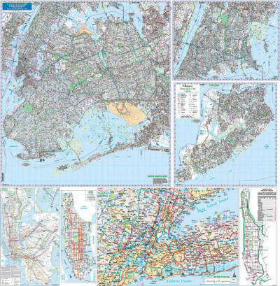 |
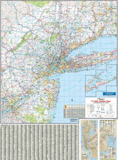
Item # KP15911 New York City Five Boroughs wall map is printed in color with a markable and washable laminated surface. Major streets are indexed in a separate book. Streets are indexed in a separate book. Areas of Coverage: The five boroughs of Bronx, New York (Manhattan), Queens, Kings (Brooklyn), and Richmond (Staten Island). Four insets include: A) NYC Subway System; B) Bus Route –Manhattan; C) Manhattan Address Finder D) NYC Area Map. East: Huntington Station-Suffolk County; South: Atlantic Ocean; North: White Plains in Westchester County NY; West: All of Essex County NJ and Bloomingdale in Passaic County. NJ. Details include: All streets, State & County Highways, Interstate Highways, Airports, Schools, Parks & Golf Courses, Hospitals, Railroad routes, Country Clubs, Cemeteries, Longitude & Latitude, Block Numbers, ZIP Codes & Boundaries and Other Points of Interest. Wall Map Measures: 69" x 67" Scale of 1’’ = 3122 feet Framing rails are included on top and bottom for easy wall mounting. $215.99 - $269.99 (free s/h)
|
||
|
|||
|
|
|||
Bronx, New York
Wall Map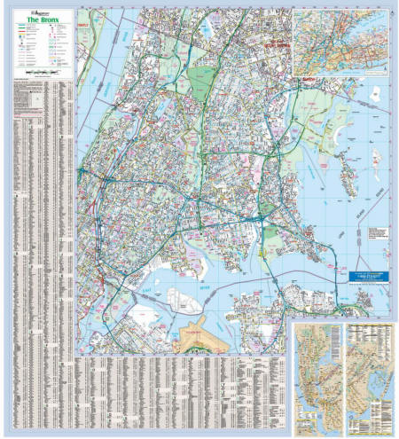 |
Item # KP15961 Printed in color with a markable and washable laminated surface. Hanging options of spring roller; or rails, mounted top and bottom. Streets are indexed on the face of the map, plus index book form. Areas of Coverage: The New York City borough of The Bronx. Coverage includes North: portions of Yonkers, Mount Vernon in Westchester County; South: to La Guardia Airport; East: to Long Island Sound including City Island & Hart Island; West: portions of Manhattan. NYC Subway Transit System Inset. Details include: All streets, State & County Highways, Interstate Highways, Subway & Railroad lines, Cemeteries, Neighborhood Names, Schools, Parks & Golf Courses, Points of Interest, Post Offices, Hospitals, ZIP Codes & boundaries, Block Numbers, Longitude & Latitude. Wall Map Measures: 56" x 51.5" Scale of 1″ = 1,230 feet
|
||
|
Call us toll-free 877-822-9889 or 812-333-2772 for orders/questions Mon.-Sat. 10:00 am-5:30 pm Eastern Standard Time
|
|||
|
|
|||
|
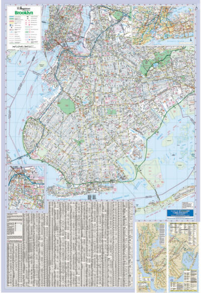
Brooklyn, New York Wall Map
|
Item # KP18932 Wall map features complete street detail; is printed in color, with a markable and washable laminated surface; and offers a street index printed on the map.
The area of coverage includes the New York City borough of
Brooklyn, with the following boundaries: The Brooklyn, NY Wall Map also includes inset maps of: Downtown Brooklyn, and the NYC Subway Transit System; and a NYC 5-Borough/Northern NJ area map.
Details and features include: Wall Map Measures: 48" x 71" |
||
|
Call us toll-free 877-822-9889 or 812-333-2772 for orders/questions Mon.-Sat. 10:00 am-5:30 pm Eastern Standard Time
|
|||
|
|
|||
|
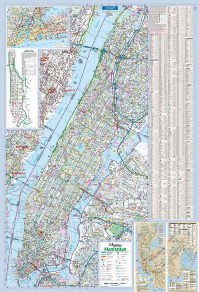
Manhattan, New York Wall
Map
|
Item # KP27275 Printed in color with a markable and washable laminated surface. Hanging options of spring roller; or rails, mounted top and bottom. Streets are indexed on the face of the map. Areas of Coverage: The New York City borough of Manhattan. Area map of Tri-State Area. NYC Subway Transit System Inset. Details include: All streets, State & County Highways, Interstate Highways, Airports, Subway & Railroad lines, Cemeteries, Neighborhood Names, Schools, Parks & Golf Courses, Points of Interest, Post Offices, Hospitals, ZIP Codes & boundaries, Block Numbers, Longitude & Latitude. Wall Map Measures: 50" x 72" Scale of 1″ = 950 feet |
||
|
Call us toll-free 877-822-9889 or 812-333-2772 for orders/questions Mon.-Sat. 10:00 am-5:30 pm Eastern Standard Time
|
|||
|
|
|||
Nassau
Co.,
New York Wall Map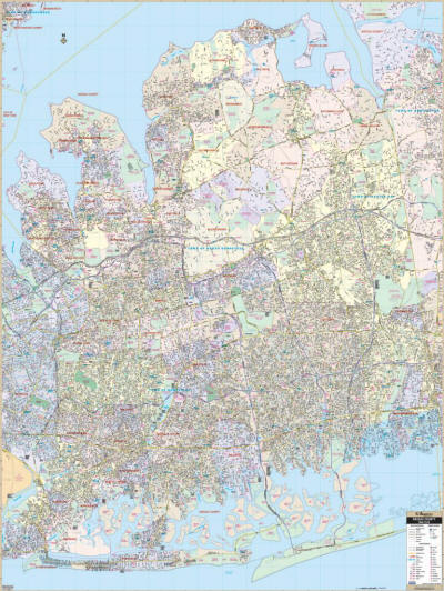 |
Item # KP15967 Nassau County, New York Wall Map features complete street detail. Printed in color with a markable and washable laminated surface. Streets indexed in a separate book. Area of coverage: North: to Long Island Sound; South: to the Atlantic Ocean; East: to Huntington; West: to the John F. Kennedy Airport. Details include all streets and highways, government buildings, airports, water features, fire/police stations, hospitals, shopping centers, educational facilities, railroads, recreational parks, golf/country clubs, city limits/annexations, cemeteries, ZIP codes/boundaries, and points of interest. Wall Map Measures: 54" x 72"
|
||
|
Call us toll-free 877-822-9889 or 812-333-2772 for orders/questions Mon.-Sat. 10:00 am-5:30 pm Eastern Standard Time
|
|||
|
New
York Tri-State Wall
Map
|
Item # KP15921
The area of coverage Including: Nassau, Orange, Putnam,
Rockland, Suffolk, and Westchester Counties, and portions of
Duchess and Ulster Counties; and the Five Boroughs, in New
York; Airfield, Litchfield, and New Haven Counties, and
portions of Hartford and Middlesex Counties, in Connecticut;
Bergen, Essex, Hudson, Hunterdon, Mercer, Middlesex,
Monmouth, Morris, Passaic, Somerset, Sussex, and Warren
Counties, and portions of Burlington and Ocean Counties, in
New Jersey, with the following boundaries:
Details and features include: Wall Map Measures: 48" x 64"
|
||
|
Call us toll-free 877-822-9889 or 812-333-2772 for orders/questions Mon.-Sat. 10:00 am-5:30 pm Eastern Standard Time
|
|||
|
|
|||
|
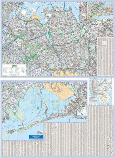
Queens,
New York Wall Map
|
Item # KP15981 Wall map is printed in color with a markable and washable laminated surface. Streets are indexed on the face of the map, plus index book form. Areas of Coverage: The New York City borough of Queens. Coverage includes North: to East River; South: to Rockaway Beach; East: portions of Nassau County, New Hyde park, Valley Stream & Cedarhurst; West: New York County Line. Area map of Tri-State Area. NYC Subway Transit System Inset. Details include: All streets, State & County Highways, Interstate Highways, Subway & Railroad lines, Cemeteries, Neighborhood Names, Schools, Golf Courses & Country clubs, Points of Interest, Post Offices, Points of Interest, Hospitals, ZIP Codes & Boundaries, Block Numbers, Parks, Longitude & Latitude, & Airports. Wall Map Measures: 51" x 72" Scale of 1″ = 1,724 feet |
||
|
Call us toll-free 877-822-9889 or 812-333-2772 for orders/questions Mon.-Sat. 10:00 am-5:30 pm Eastern Standard Time
|
|||
|
|
|||
|
Please call us toll-free 1(877) 822-9889 for orders/questions Mon.-Sat. 10:00 am-5:30 pm
New York State Map by Universal Maps, Item # KP-State
Sale Price: $169.00 - $429.00, New York Classroom Map, Up-to-date Cartography, Pull-down Map, New York Wall Map, Laminated Maps, Markable Maps, Wall Map on Roller
Educational Maps are designed to present the world in a way that is visually appealing and east to understand
|
Home | Products | About Us | Contact Us | Helpful Links | Return and Privacy Policies | Site Map | International Orders |
||||||||||||||
|
|
|||||||||||||
|
Site Map | Privacy Policy | Easy Return/Exchanges | APO/FPO Orders | No Minimum Order + FREE Shipping (contiguous USA) |
||||||||||||||