Home | Call us toll-free 877-822-9889 or 812-333-2772

world.gif (9321 bytes)

   1st Stop Travel & Globe Store   

world.gif (9321 bytes)
Cyber Sale Large Selection Great Quality No Minimum Orders Buy Gift Certificate

 World Globes Maps Travel Accessories Ameribag Home Furnishings Free Shipping*

Wall Maps  > State Maps

State Wall Maps on Rollers

Sale Price: $99.99 - $599.99  (free shipping/handling) or 6 monthly installments with PayPal Credit   Retail $129.00 - $695.00  
Durable & Educational State Wall Maps

Our state wall maps are as visually appealing as they are informative - making them an excellent resource for studying state history, regions, economics, government, and geography.
  • Easy to Read: Clear labeling and vibrant colors for effortless reference.
  • Durable Construction: Fully laminated and printed on tough, non-tear material for long-lasting use.
  • Markable Surface: Works with dry-erase or water-soluble markers for interactive learning.
  • Accurate & Up-to-Date: Contains the latest references and geographical data.
  • Classroom Ready: Ideal for public, private, and home school settings.

Perfect as both a functional teaching tool and an attractive classroom display.

 
Alabama Louisiana Ohio
Alaska Maine Oklahoma
Arizona Maryland Oregon
Arkansas Massachusetts Pennsylvania
California Michigan Rhode Island
Colorado Minnesota South Carolina
Connecticut Mississippi South Dakota
Delaware Missouri Tennessee
Florida Montana Texas
Georgia Nebraska Utah
Hawaii Nevada Vermont
Illinois New Hampshire Virginia
Idaho New Jersey Washington
Indiana New Mexico West Virginia
Iowa New York Wisconsin
Kansas North Carolina Wyoming
Kentucky North Dakota  

Please call us toll free 877-822-9889 for information about regional and city maps.

moving picture of american flag Made in United States

Please click here to view Wall Map finishing option descriptions


Map Finish & Mounting Options:

We offer a variety of finish and mounting choices to suit your needs:


  • Laminated Maps – Durable and markable for long-lasting use
    Paper Maps – Lightweight and economical
    Laminated Maps on Spring Rollers – Pull-down style for easy storage and display
    Laminated Maps with Rails – Clean, professional finish for wall mounting
    Laminated Maps on Spring Rollers with Steel Backboard Support – Ideal for heavier multi-map wall sets

If you’d like to frame your map, please call us toll-free at 877-822-9889 for a current quote.


Call us toll-free 877-822-9889 or 812-333-2772 for orders/questions Mon.-Sat. 10:00 am-5:30 pm Eastern Standard Time


State Wall Maps Formats

Thematic State Wall Map State Wall Map Shaded Relief Wall Map

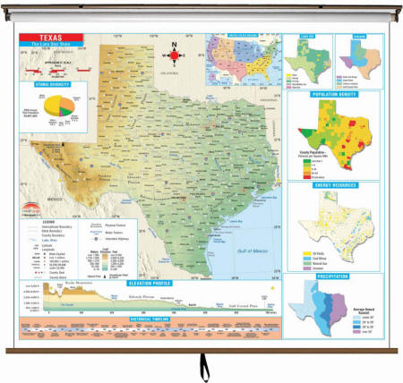
Thematic Wall Map is the perfect teaching aid for state studies and related subjects. Political/physical maps with hypsometric colorations; shows county boundaries, interstate highways, county seats, cities and towns and state regions.

* Offered for the following states: Arkansas, California, Florida, New Jersey, New Mexico, New York, North Carolina, Oklahoma, Texas and Utah.

Maps correlate with state standards and curriculum guidelines. They are constructed of heavy paper, with a write-on/wipe-off laminated finish that can be used with water-based or dry erase pens. Mounted on spring roller with backboard.

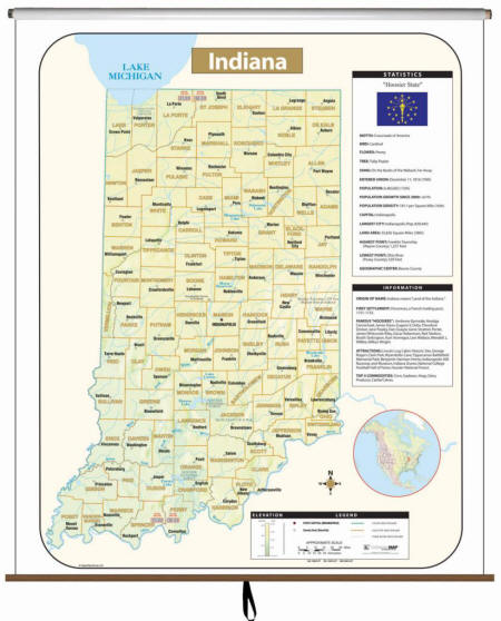
Primary (K-3) Thematic Wall Maps feature basic state information; shows the state capital and major cities; state flag, state seal and motto, state tree, flower and bird.

Intermediate (3-8 grade) Thematic Wall Maps feature a historical timeline and elevation profile, plus insets of land use, ethnic diversity and population, average precipitation and more.

Printed in color with a markable and washable surface.

Indexed on the face of the map. Mounted top and bottom with hanging rails or mounted on spring roller.

Details include all state and federal highways, major waterways, state universities, military installations, major airports, cities and towns, state and national parks, wildlife areas, mileage charts, mileage circles, longitude and latitude lines, county names and boundaries, exit numbers, and points of interest.


Colorful and easy to read. A colored bar graph clearly shows variations in elevation. Includes boundaries, geographical features, time zones and more.
Wall Map Mounting Options
 
We supply wall maps and world globes to classrooms at our local Monroe County School Corporation
in Bloomington, Indiana, and to other schools, Colleges, private and government institutions in US and abroad.

Large rolled wall maps, classroom maps, pull down maps, pull up maps, school maps, markable, mounted State Wall Maps

World Globes and Maps make great gifts for Geography Buffs. Perfect as Retirement Travel Gifts, Business & Executive Gifts, Bon Voyage & Graduation Presents


Home Products | About Us | Contact Us | Helpful Links | Order, Return & Privacy Policies Site Map  | International Orders

e-mail: traveler@1ststoptravelstore.com
Address: 317 East Dodds Street, Bloomington, IN 47401 USA
Telephone: 812-333-2772
Toll Free: 877-822-9889
Mon.-Sat. 10:00 am-5:30 pm EST (10:00-17:30)
 
Our Shopping Cart - holds a Secure Web Server Certificate by McAfee and offers PayPal, Venmo, Coinbase and major credit cards for your convenience.

Credit card logos of AMEX VISA Discover and AMEX Acceptance Mark Venmo logo Coinbase logo


Site Map | Privacy Policy | Easy Return/Exchanges | APO/FPO Orders | No Minimum Order + FREE Shipping (contiguous USA)